Introduction to the challenge
Rainwater management is becoming increasingly challenging as a result of intensive urbanisation, the continuing increase in paved surfaces and the expected impact of climate change on precipitation. Rainwater plans with a region-wide vision on rainwater management provide the answers.
Our approach
Stapsgewijze aanpak met basishemelwaterplan en detailhemelwaterplannen

For the establishment of rainwater plans, HydroScan developed its own methodology for both basic and detailed rainwater plans. This methodology is based on, and complies with, the relevant recommendations of the Coordination Commission on Integrated Water Policy (CIW) but can be seen as a more concrete implementation of those recommendations.
Methodology for basic rainwater plans
In the basic rainwater plans, the available information is used as basis to develop a vision on rainwater management within the municipality, with a strong focus on the use of at-source measures and collective buffer and infiltration facilities.
This process involves the following steps:
Depending on the available budgets, the choice can be made to implement certain steps only for top priority sub-regions.
Methodology for detailed rainwater plans
In the detailed rainwater plan, the vision from the basic rainwater plan is elaborated in greater detail (possibly for a specific area within the municipality), including hydraulic optimisation of the main rainwater drainage lines based on hydraulic modelling.
This comprises the following activities:
Our solution
Rainwater plans with focus on the use of at-source measures and collective buffer and infiltration facilities
The above methodology has already been applied successfully in various cities and municipalities within Farys' working area:
- City of Ghent: Establishment of detailed rainwater plan for various municipal districts
- Municipality of Beersel: Establishment of detailed rainwater plan
- Municipality of Melle: Establishment of basic rainwater plan
- Municipality of Buggenhout: Establishment of basic rainwater plan (under development); Establishment of detailed rainwater plan for eastern part (centre of Buggenhout, Opdorp, Hoge Briel) planned
Example:
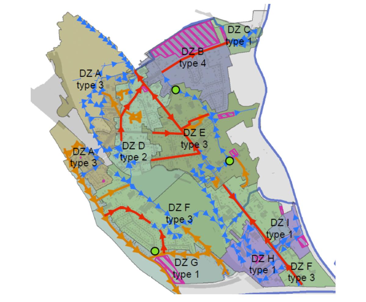
In the municipality of Beersel, the detailed rainwater plan is used as an operational tool that helps with the planning of preventive projects and with setting the right priorities.
Our solution
Proactive and preventive approach to prevent or mitigate the impact of exceptional rainfall
Share this page
Call or mail us
Interested? How can we help you?
Do not hesitate to tell us about your situation or ask any questions you may have.
Did you also know that with a quick scan, we can easily predict your potential annual savings?
Send an email or call +32 16 24 05 05.
Did you also know that with a quick scan, we can easily predict your potential annual savings?
Send an email or call +32 16 24 05 05.
![[:swvar:ufile:1:description:]](/swfiles/files/logo_hydroscan_rgb.png?nc=1745319552)
